Chinaman Creek Community Plan

Muckleford Landcare has commenced the development of a community plan for the Chinaman Creek valley.  The aim of the project is to develop a long term plan for the economic and environmental resilience of the Chinaman Creek catchment, and to prioritise and secure funding for immediate works in association with Connecting Country.

In early June most landholders in the valley received a questionnaire aimed at creating a snapshot of the current state of the catchment, and gaining some idea of the residents’ visions for the future. The data from the survey is being compiled by Landcare Facilitator, Max Schlachter, for presentation to a meeting of interested parties on Saturday, June 23. Using input gained from the survey responses and from this session Max will begin drafting a detailed plan.

All people interested in finding out more and/or contributing to the process are warmly invited to the meeting. Afternoon tea will be provided.

Chinaman Creek Community Plan Meeting

Ray Bradfield Room (adjacent to Maxi IGA carpark)

Castlemaine

Saturday, June 23, 2 – 3.30 pm

Further information:

Paul Hampton – paul-hampton1@bigpond.com or 54742189

Prescribed burning

The Spring of 2011 saw quite a deal of prescribed burning in the Muckleford Forest as part of DSE’s fuel reduction program.  Now is a good time to walk through the Forest and see the impact of this burning.  And it is timely to question the value of prescribed burning overall, as discussed in a recent edition of Background Briefing on ABC Radio National – follow this link to listen to the program  http://www.abc.net.au/radionational/programs/backgroundbriefing/2012-02-19/3829372

Plus there is recent research questioning the extent to which Aboriginal people used fire to control vegetation – http://www.abc.net.au/science/articles/2010/12/06/3085726.htm

For a first hand look at the impact of prescribed burning in the Muckleford Forest, you may like to join the first of the FOBIF bushwalks for 2012 – details here – http://www.fobif.org.au/walks/

Muckleford Gorge

Members and supporters of local Landcare groups had a rare opportunity to visit the Muckleford Gorge on Sunday 15 May.  The visit was scheduled as an activity of the Friends of the Box Ironbark Forests group (FOBIF).  As a first-time visitor to this much-vaunted but somewhat secretive location, I was wondering if the Gorge would live up to expectations.  I am happy to report that the Gorge was even more spectacular and stunning than anticipated, no doubt enhanced by the volume of water still flowing down its midst.

A large group of walkers assembled at the Point View property for a welcome by owner and sheep farmer Ian Garsed.  Unfortunately, due to the vicissitudes of local football, Ian was unable to accompany us on the walk.

The first section of the walk was along the eastern ridge of the Gorge and then down the track to the river flats and The Palace, a favourite gathering place for the Garsed family.  Down close to the creek the evidence of the January floods was still prominent in the fences, in the trees and along the creek bed.

After crossing the creek we climbed to the top of the western ridge, noticing the very different geological structure and vegetation.  From the top of the ridge the volcanic structure of the eastern side of the Gorge was most evident.

From here the group descended to one of the most scenic sections of the Gorge featuring some impressive rock walls, significant trees and wonderful native grasses.  There was still a steady flow of water through the Gorge but some of the pools afforded lovely reflections.

Further along the creek we discovered some interesting specimens of Dianellas along with a number of small ferns emerging from various rock formations.

On the eastern bank of the Gorge a number of large eucalypts were impressively intertwined with the surrounding rock formations. enabling them to cling to some precarious positions over the creek.

Climbing back out of the Gorge we passed some fine examples of sedimentary rock laid down in layers and uplifted by earth movements.  These rock formations were home to an all together different range of plant life, principally fungi and mosses.

The group returned to the ford and The Palace for a debrief with Ian Garsed.  A number of interesting aspects of the history and the usage of the Gorge were discussed.  Finally the walkers climbed back up to the eastern plateau and the conclusion of the expedition.

Muckleford Gorge is a very special feature of our local landscape and one with high conservation values.  The Gorge is currently under a Bush Tender conservation agreement between the landowner and DSE.  This arrangement should ensure that the unique aspects of the Gorge will be maintained and enhanced for the foreseeable future.  For this we should all be very grateful.  And if you ever have an opportunity to visit Muckleford Gorge (with the active consent of the landowner, of course) don’t miss it!

Victorian Goldfields Railway (VGR) Project

In 2005 Muckleford Catchment Landcare Group planted native shrubs and some trees within the railway easement east of the Walmer Road crossing.  Plants have established so well that in some areas sight lines for the train drivers were being obstructed by vegetation, and in other areas natural recruitment has encroached on regulation clearances from the track.  We met with VGR and Mt Alexander Shire Council to identify the issues and agreed that the most efficient way to dispose of prunings would be to mulch on site.

Pruning was done after the January floods and (thanks to Dave’s 4WD tractor) the chipper got in and out of the site with barely a tyre mark left as evidence!  Stands of Wattle and River Red Gum were thinned, and other trees pruned to give better visibility to the roadway and signals.  David Watkins from VGR was a great help dragging branches to the chipper.  There has been a lot of recruitment of River Red Gum and Silver Wattle close to the rail tracks and these small trees were cut and poisoned.

It is gratifying to hear that David from VGR and many passengers admire the plantings – especially when they flower in spring.  They enhance the variety of vegetation types that line this popular tourist attraction.

Tractor and chipper in place and ready for work
The crossing area after tree thinning and pruning with our project sign now visible too!

Creasys Road Corridor project

Nearmap image showing eastern part of project (2/2/10)

The purpose of this project is to provide a link between quality roadside vegetation in Turners Lane to the riparian zone of Chinaman Creek by establishing a range of trees and shrubs along a treeless 800 metre section of Creasys Road. The project commenced in 2009 with the support of 4 adjoining landholders, NCCMA 2nd Generation funding, Mt Alexander Shire Council and the CFA. The roadside planting of over 35 species extends into private land to form a corridor up to 35 metres wide. Land adjoining Turners Lane was also planted where an old direct seeding project had limited success.

Good soil preparation made planting out the 6,000 or so plants relatively easy, but the intimidating task of guarding was tackled by a marvellous group of dedicated volunteers. Because site preparation included rigorous rabbit control measures (spray and remove blackberry, fumigate and destroy warrens) there is very little evidence of predation. We have systematically removed some tree guards but with rapid growth in recent months the remaining plants now need liberating. These guards are being stockpiled for reuse in future planting projects.

The images above show the middle of the project area 6 months after planting (top) and at 18 months (below). The Black Wattles in the Creasys Road verge are now at least 2 metres tall. Eucalypts are just emerging above the tall Phalaris and Spear Grass.

Images were taken Feb 2010 (top) and Feb 2011 (below). The east area has been netted to keep out rabbits so the 2,000 plants did not need guarding. This zone has a mix of local species and a few interlopers such as Flooded Gum (Eucalyptus grandis). These have performed remarkably well tolerating frost, dry spells and inundation and their growth rates have exceeded the other plants in this area.

The connection to Chinaman Creek is predominantly Silver Wattle, River Red Gum and Bursaria. Plantings in the creek flat survived recent flooding which took out fencing but conveniently flattened the 2m high thistles!

Images taken Feb 10 (top) and Feb 11 (below). Turners Lane cnr Creasys Road – images taken on 13/9/09 (left) and 2/2/11 (right). The soil in this elevated area had no structure – it was like damp talcum powder – and although growth rates are relatively slow the majority of plants have survived. There is competition for moisture from the mature Grey Box in Turners Lane.

Image at top taken 2/2/11 from eastern extent of project looking west; image below is the same area during the burning of target sprayed Phalaris around the dam on 1/8/09.

Chemical use was limited to spraying of Blackberry, St Johns Wort and Phalaris stands near the existing dam.

During winter we burnt the dead patches of Blackberry, then fumigated and collapsed the exposed rabbit warrens during the following weeks. The control of weeds within planting strips was achieved by cultivation prior to planting in spring. Cultivation at this time also helps to warm up soil which facilitates root growth in the new plantings. We minimised chemical use to preserve soil bacteria and microorganisms.

Growth and establishment rates have varied over the project area. Some areas were too rocky to prepare and plant out. Plant mortalities occurred in a poorly drained area of heavy clay between the dam and Creasys Road and a patch within the Chinaman Creek connection where there may have been an old sheep dip. Over recent months the constantly wet soil conditions killed some established plants; Hedge Wattle (Acacia paradoxa) was affected, while Woolly Tea-tree (Leptospermum lanigerum) has coped well with both dry and wet sites. Using a wide range of species in the project has assisted the plant survival rates.

Overall plant mortality has been estimated at less than 5% which is remarkable given that we did not water in at planting time. The plants have been wholly dependent on rainfall. Ripping allowed plant roots access to moisture deep in the soil profile and the cultivation helped root establishment. This soil preparation also sped up the planting process – vigorous hiko stock was planted with a Pottiputki at a leisurely rate of around 1,000/day per person.

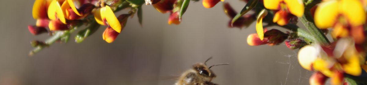
It is exciting to see this previously exposed and uninviting area being transformed. We look forward to seeing more bird and insect life – already Stubble Quail and a number of small birds have been spotted!

Walmer Biolink Takes Shape

Muckleford Landcare has installed 90 nest boxes in the Walmer South Nature Reserve and an adjoining road reserve in order to provide refuge and breeding opportunities for wild-life in the reserve and nearby tracts of bushland such as Ottrey’s Scrub to the north. The area currently contains several scattered hollow-bearing old trees and a limited number of branch and trunk cavities. Many of these are accessible to predators such as the red fox.

Installing a nest box

Target species for the project include the Brush-tailed Phascogale, Microbats, Sugar Gliders and a range of birds.  Some are prey species for Powerful Owls and other raptors that forage in this area. A range of nest boxes designed by Miles Geldard were commissioned. Each box has been identified by a numbered aluminium tag and GPS location in order to facilitate future monitoring and maintenance.

Example of nest box

The project is a partnership between Muckleford Landcare and Parks Victoria and has been made possible with a Second Generation Landcare Grant from the North Central CMA.

Walmer South Nature Reserve